| Author |
Title |
Year |
Price |
[MACPHERSON (Alexander)]
|
Catalogue of Maps, Prints, Drawings, Etc. Forming the Geographical and Topographical Collection attached to The Library of His late Majesty King George the Third, and Presented by His Majesty King George the Fourth to The British Museum.
|
1829 |
£475.00 |
ASHER (G. M.)
|
Prospectus of a Bibliographical and Historical Essay on the Dutch Books and Pamphlets Relating to New-Netherland, and to the Dutch West-India Company, as also on the Maps / Charts / etc. of New-Netherland, accompanied by an historical map of the country. Compiled from the Dutch public and private libraries, and chiefly from the collection of Mr. Frederik Muller in Amsterdam. [Amsterdam: Frederik Muller, 1854.] [Bound with:] A List of the Maps and Charts of New-Netherland, and of the views of new-Amsterdam.
|
1854 |
£145.00 |
AUSTRALIA.
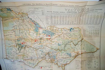
|
State of Victoria Commonwealth of Australia. Showing Water Supply, Agriculture, Railways and other features. Principal Agriculture and Pastoral Features of the various Districts or the State of Victoria, Season 1924-25. Taken from "Victoria—The Speedway to Rural Prosperity" Handbook for Intending Settlers.
|
1925 |
£125.00 |
BAYNTON-WILLIAMS (Ashley)
|
Town and City Maps of the British Isles 1800-1855.
|
1992 |
£30.00 |
BRICKER (Charles)

|
A History of Cartography: 2500 Years of Maps and Mapmakers. Maps chosen and displayed by R. V. Tooley, Preface by Gerald Roe Crone.
|
1969 |
£40.00 |
BURDEN (Philip D.)
|
The Mapping of North America (A List of Printed Maps; 1511-1670).
|
1996 |
£150.00 |
BURDEN (Philip D.)
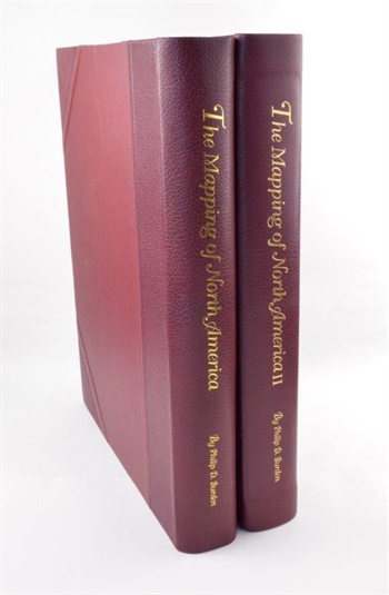
|
The Mapping of North America (A List of Printed Maps; 1511-1670). [Sold with:] The Mapping of North America II (A List of Printed Maps; 1671-1700).
|
2007 |
£440.00 |
BURDEN (Philip D.)
|
The Mapping of North America II (A List of Printed Maps; 1671-1700).
|
2007 |
£190.00 |
BURDEN (Philip D.)
|
The Mapping of North America II (A List of Printed Maps; 1671-1700).
|
2007 |
£190.00 |
CHUBB (Thomas)
|
The Printed Maps in the Atlases of Great Britain and Ireland. A Bibliography, 1579-1870. With an Introduction by F.P. Spent, and Biographical Notes on the Map Makers, Engravers and Publishers.
|
1927 |
£50.00 |
COLBY (Colonel T. F.)
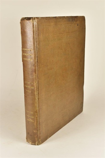
|
Ordnance Survey of the County of Londonderry. Volume the First [all published].
|
1837 |
£185.00 |
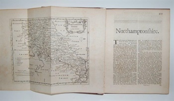
COX (Thomas)
|
Northamptonshire [Taken From] Cox's Magna Britannia et Hibernia Antiqua et Nova.
|
1720 |
£45.00 |
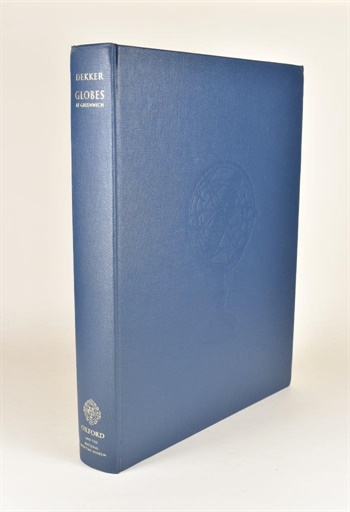
DEKKER (Elly)
|
Globes at Greenwich. A Catalogue of the Globes and Armillary Spheres in the National Maritime Museum, Greenwich.
|
1999 |
£275.00 |
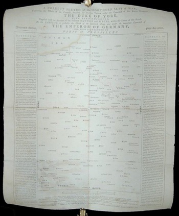
FIRST WAR OF THE COALITION.
|
A Correct Sketch of the Northern Seat of War, Exhibiting the Whole of the Country, wherein the British Troops under the Command of His Royal Highness the Duke of York, have been employed. Together with an account of the different battles and sieges, within the extent of this sketch. As the capital is probably the object of the combined army, now under the immediate command of the Emperor of Germany, the view is extended to Paris & Versailles.
|
1794 |
£550.00 |
GIMSON (Basil L.) & RUSSELL (Percy)
|
Leicestershire Maps: A Brief Survey.
|
1947 |
£12.00 |
GREENWOOD (Christopher & John)
|
Atlas of the Counties of England [and Wales], from Actual Surveys made from the Years 1817 to 1833.
|
1834 |
£1295.00 |
HARVEY (P. D. A.) & THORPE (Harry)
|
The Printed Maps of Warwickshire 1576-1900.
|
1959 |
£25.00 |
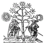
JUVENILE.
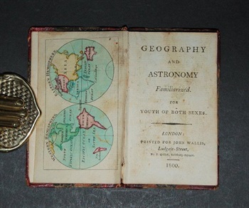
|
Geography and Astronomy familiarized. For Youth of both sexes.
|
1800 |
£175.00 |
KERSHAW (Kenneth A.)
|
Early Printed Maps of Canada. I. 1540-1703.
|
1993 |
£65.00 |
KING (William)
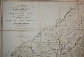
|
A Map of a Tract of Country Surrounding Belvoir Castle; Including Extensive Districts of the Counties of Leicester, Lincoln & Nottingham; and the whole of the County of Rutland. Accurately laid down from a Survey taken in the Years 1804.5.&6. by W. King.
|
1806 |
£950.00 |
KING'S LIBRARY, BRITISH MUSEUM.
|
Catalogue of Maps, Prints, Drawings, Etc. Forming the Geographical and Topographical Collection attached to the Library of His late Majesty King George the Third, and Presented by His Majesty King George the Fourth to the British Museum.
|
1829 |
£195.00 |
KINGSLEY (David)
|
Printed Maps of Sussex 1575-1900.
|
1982 |
£14.00 |
LAURIE AND WHITTLE.
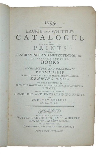
|
Laurie and Whittle's Catalogue of New and Interesting Prints: consisting of engravings and metzotintos, &c. of every size and price; books of architecture and ornaments; penmanship in all its branches, by the most eminent masters; drawing books of every description, from the works of the most celebrated artists in Europe; and the greatest variety of humorous and entertaining prints, for country dealers. &c. &c. &c. &c.printed and published by Robert Laurie and James Whittle, map, chart and print sellers, no. 53, Fleet-Street. (successors to the late Mr. Robert Sayer).
|
1795 |
£2750.00 |
LISTER (Raymond)
|
Antique Maps and their Cartographers.
|
1970 |
£9.00 |
MAIR (John)
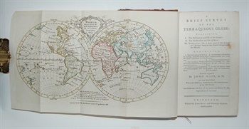
|
A Brief Survey of the Terraqueous Globe: Containing I. The Description and Use of the Globes. II. The Construction and Use of Maps. III. Geography; Or, a Short View of the Antient and Modern State of the Several Kingdom of the World...
|
1775 |
£295.00 |